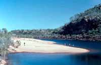
| The lower portion of the Drysdale River has long stretches of wide sandy banks. The walking is much easier than some of the rocky sections which come later. | ||
 |
 |
|
These are a selection of rather older galleries that have not yet been updated, but why miss out on them completely just because they are not
quite as shiny as the new ones?
Use your back button to return from whence you came or the links on the page to go elsewhere.
Drysdale Photo Gallery
Click the photos to see enlarged versions. Click your back button to return to this page. Hold your mouse pointer on the photos to see captions.
The lower portion of the Drysdale River has long stretches of wide sandy banks. The walking is much easier than some of the rocky sections which come later.
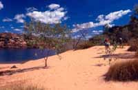
These sandy beaches make excellent camp sites. Warm to cool nights make them perfect for relaxing around the campfire. Nearby, we often find Aboriginal rock paintings.
Each of the many side creeks is interesting in its own right so we often drop our packs and go exploring.
Eventually, we reach Solea Falls, the largest waterfall on the Drysdale River. It's a great spot for swimming and fishing.
The flat rock ledges at the top of Solea Falls make an excellent campsite with wonderful sunrise and sunset views.
Our May-June trip in 2000 was the wettest we've ever had. The four photos below, courtesy of guide Bruce Swain, show you just how spectacular the waterfalls can be early in the season.
Some of the best sunsets we have ever seen have been on Drysdale trips. The two photos below were taken from the same spot, the second fifteen minutes after the first.
There is far more to see than these few photos can show. Why not join us and experience the best that Drysdale River National park has to offer. Click here to return to the description of Drysdale River National Park.
Click the links below to see the PDF notes describing our two Drysdale trips. Among other things, these explain how we get to and from the park.
Drysdale River National Park No. 1: June
Drysdale River National Park No. 2: June-July