Kakadu Super Circle No. 1
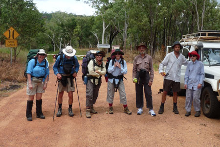
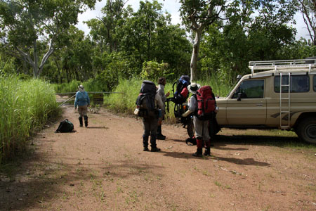
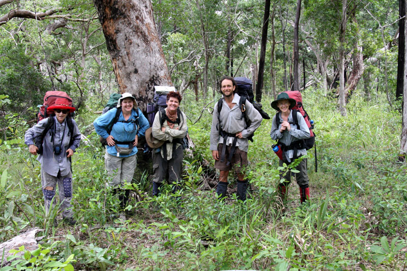
The walk begins
We drive to where the road is closed and begin from there. the first part is along the 4WD track, then along a river.
View full-size photo here.
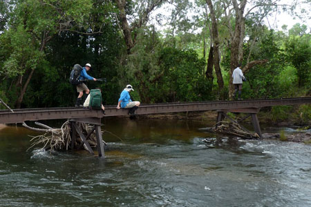
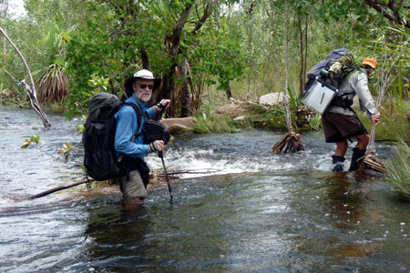
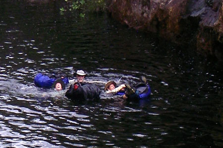
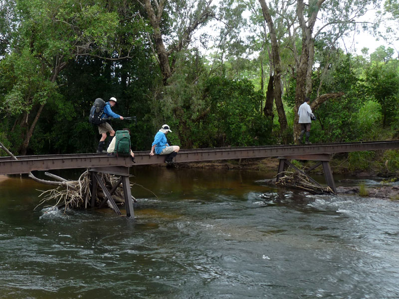
The bridge
This brings us to our first real challenge — crossing the old bridge over Koolpin Creek. Some make it look easy. Others have a harder time but we've never had anyone fall in.
View full-size photo here.
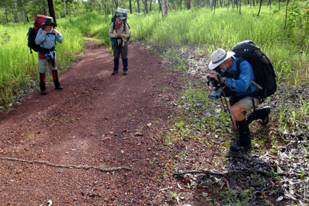
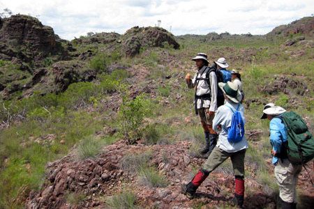
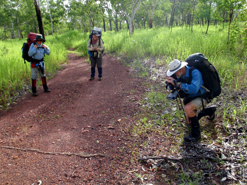
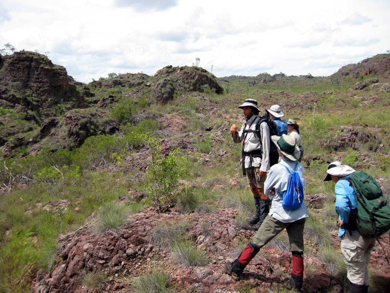
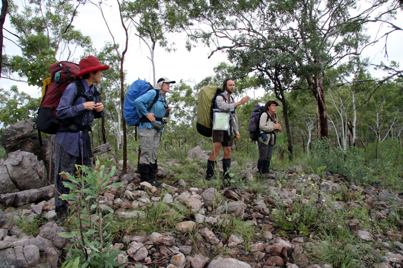
Easy walking
Once across the old bridge, the walking gets easy as we follow the old road. Here we have stopped to photograph some processionary caterpillars. It was another four months before this road was open to vehicles.
View full-size photo here.
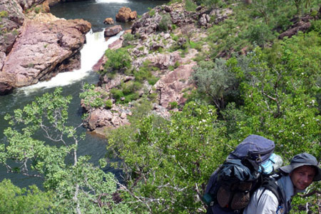
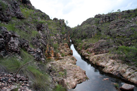
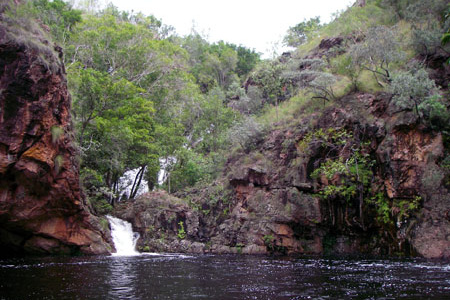
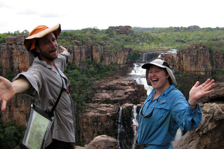
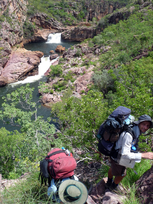
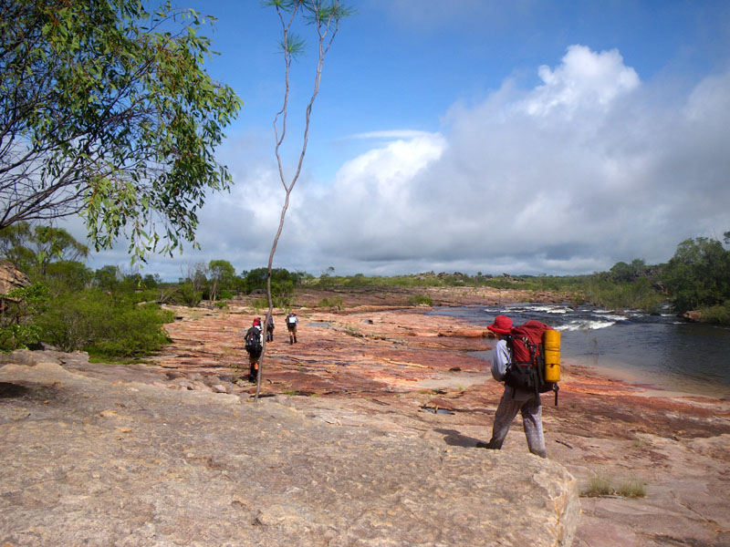
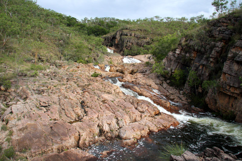
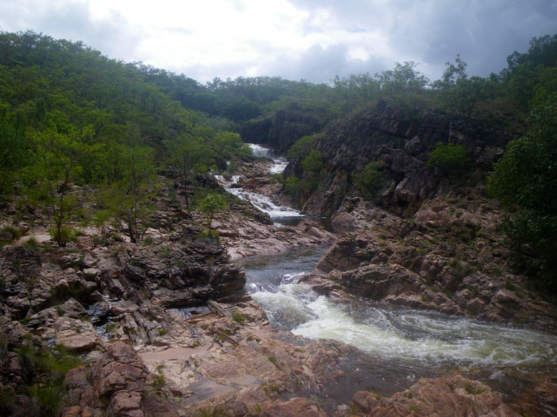
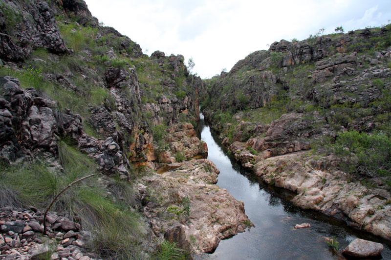
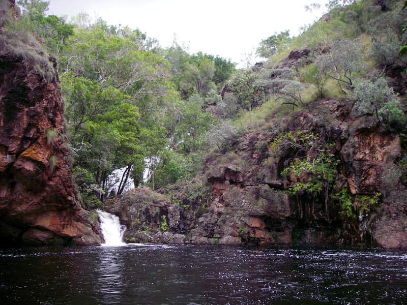
Koolpin gorge climb *
Once we get to Koolpin Gorge, we have to climb up and around the waterfalls as large crocodiles can be present below the falls at this time of year. Once above the falls, we can safely swim to our heart's content.
View full-size photo here.
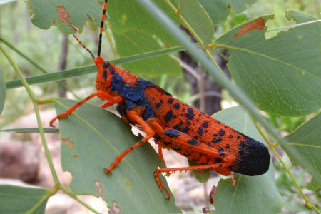
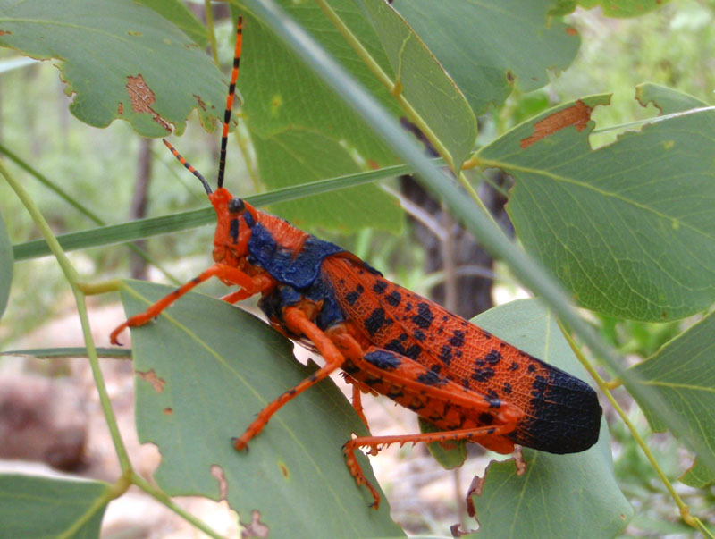
Leichhardt grasshopper
Above the falls, we saw one of the rare Leichhardt grasshoppers than inhabit the area. First described by explorer Ludwig Leichhardt in 1845, they were not rediscovered by western science until the 1970s. The local people call them Alyurr, children of the lightning man, Namarrgon.
View full-size photo here.
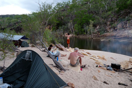
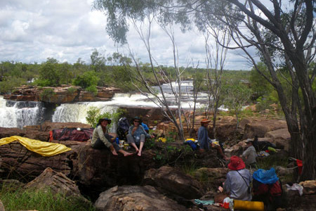
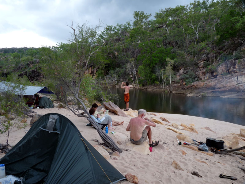
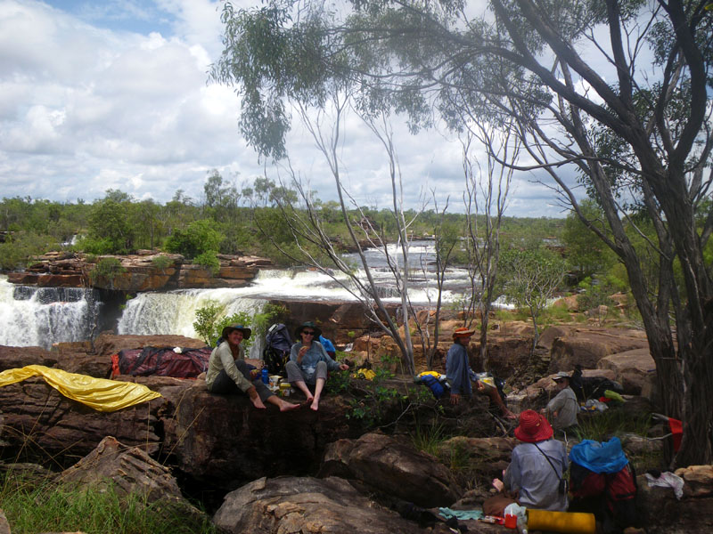
Koolpin campsite
Our first camp above the falls is on a sandy beach, next to a deep pool. No crocs here!
View full-size photo here.
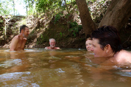
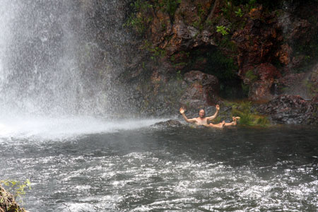
Swim stop
One of the best things about this trip is that we can stop for a swim almost anywhere, any time.
View full-size photo here.
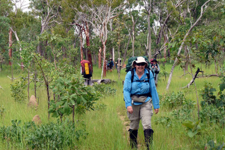
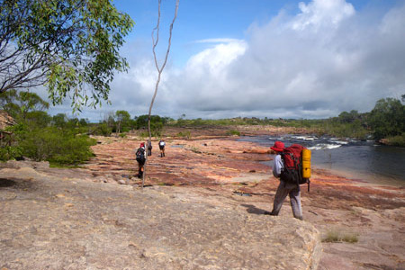
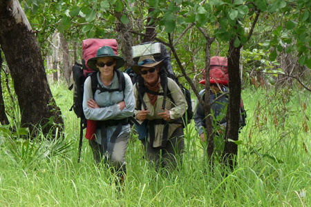
Walking through the lush, green growth of the Wet
For those who have only visited the Top End during the dry season, the lush green growth of the wet season is almost unbelievable.
View full-size photo here.
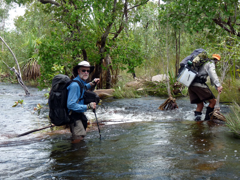
Wading across a flooded creek
Tiny creeks that are bone dry in the dry season require a wade to get across.
View full-size photo here.
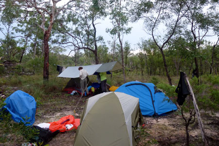
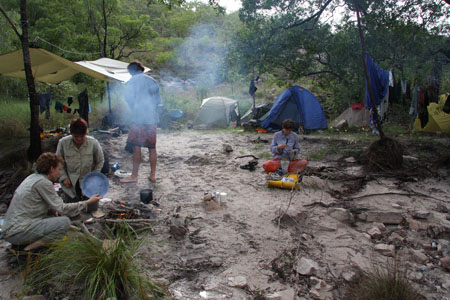
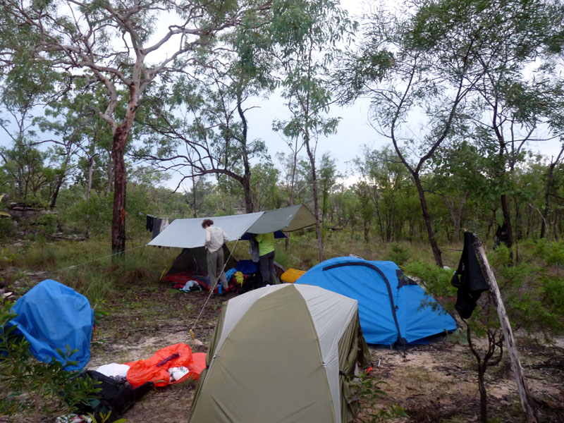
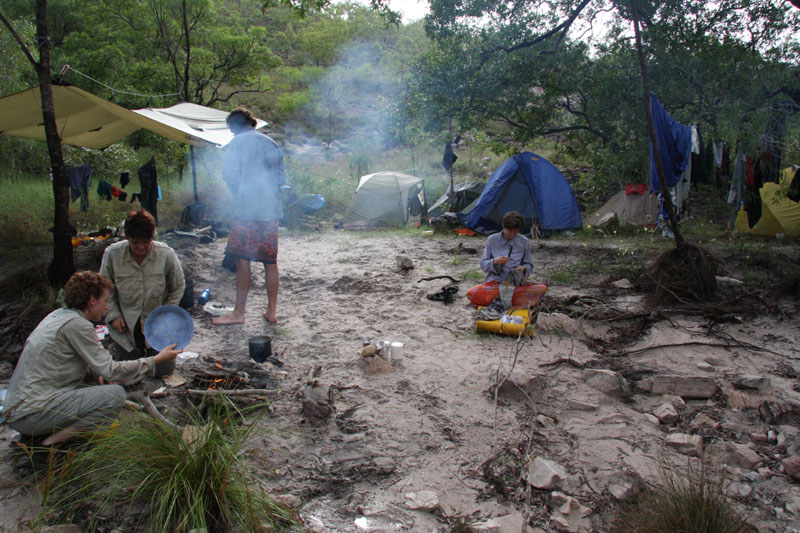
Wet season camp
The group fly shown in this campsite photo is invaluable. We can sit under it if it's raining at dinner time. Those with free standing tents can put them up and take them down under cover.
View full-size photo here.
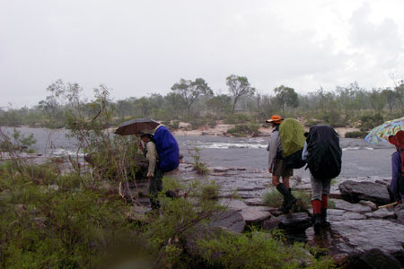
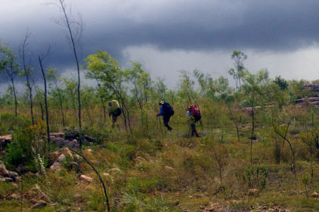
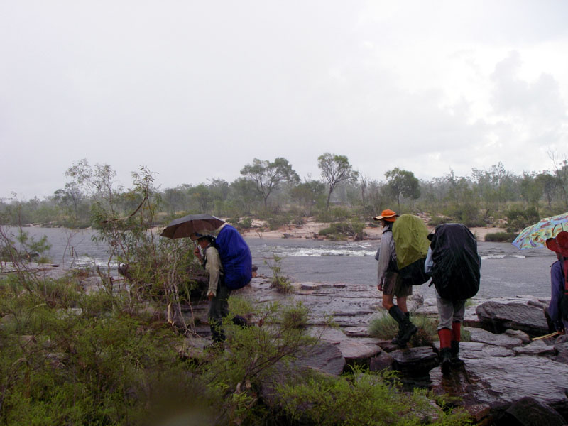
Walking in the rain
Make no mistake. This is the wet season. You are going to be walking n the rain.
View full-size photo here.
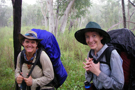
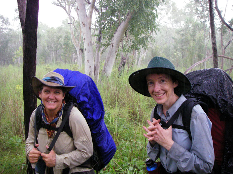
This rain is different
Tropical rain is warm! Can you imagine being this wet and smiling like this in a colder climate?
View full-size photo here.
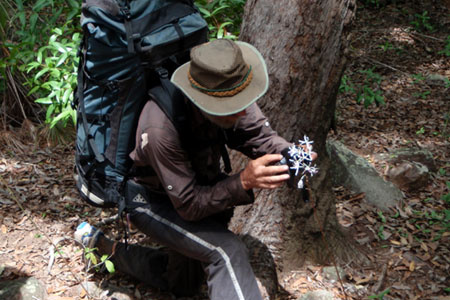
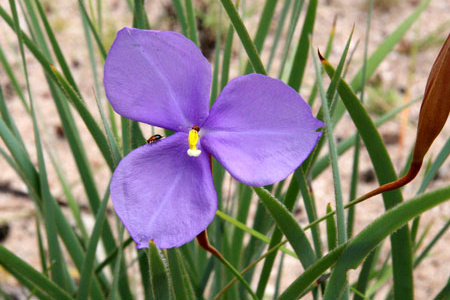
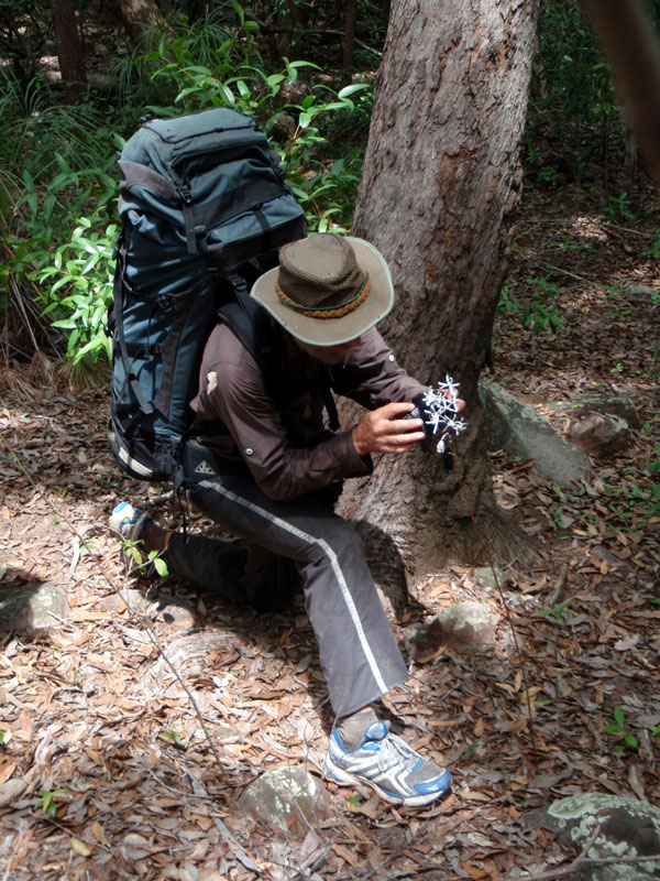
Photographing an orchid *
This is the best time of year for flowers. Here guide Russell Willis is photographing a ground orchid.
View full-size photo here.
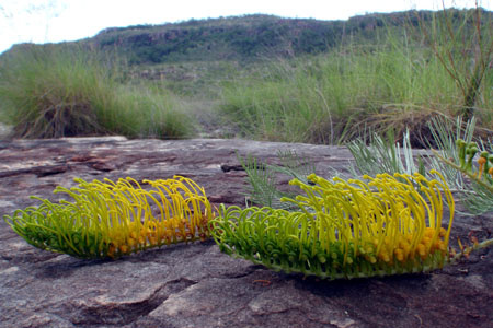
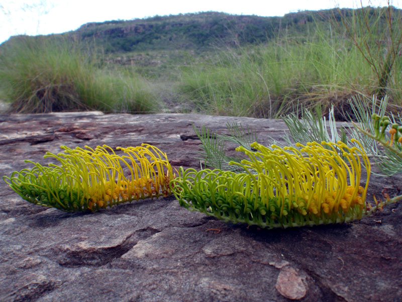
Grevillea formosa
Twenty years ago, this grevillea had not been classified. Now it is on nature strips all over Darwin.
View full-size photo here.
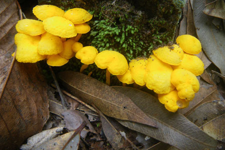
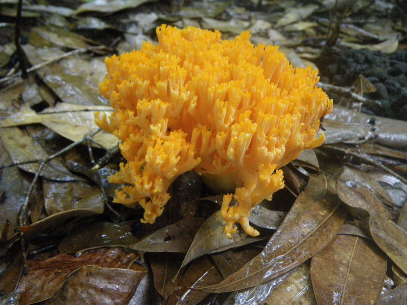
Mushrooms
It's not just the flowers that are colourful. A variety of fungi put on amazing displays.
View full-size photo here.
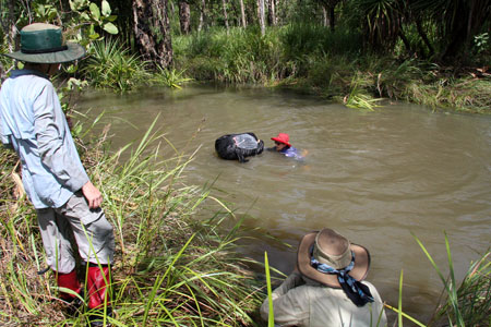
Floating packs across Twin Falls Creek
We cross Twin Falls Creek in an area where it splits into several channels, only one of which requires a short swim.
View full-size photo here.
Swim stop at the Jim Jim monoliths *
From Twin Falls Creek, we cross to Jim Jim Creek and move downstream to the monoliths, four rock pillars surrounded by water n the wet season. Look closely and you can see Aboriginal rock paintings high on the pillar.
View full-size photo here.
Walking along Jim Jim Creek
The flat rock ledges as we near Jim Jim Falls provide some of the easiest walking on the entire trip.
View full-size photo here.
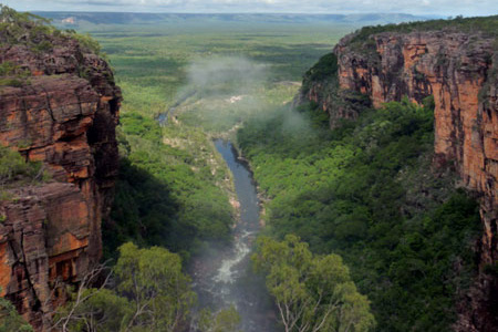
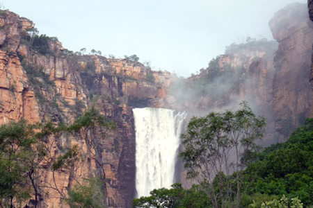
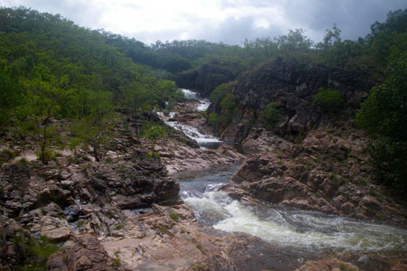
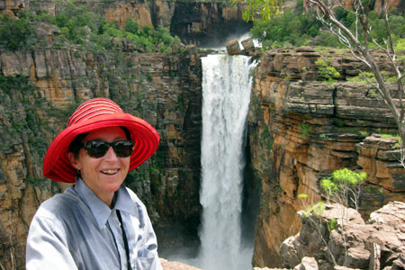
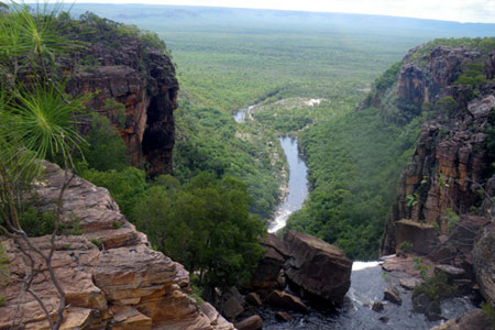
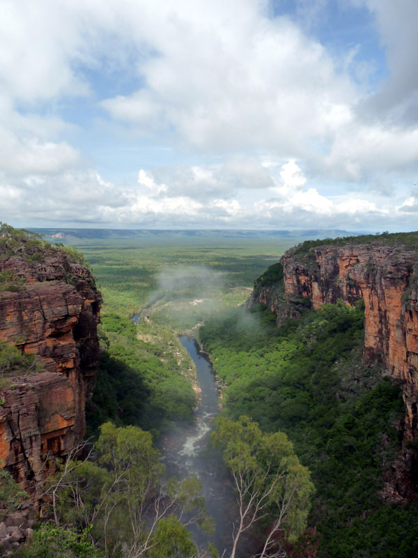
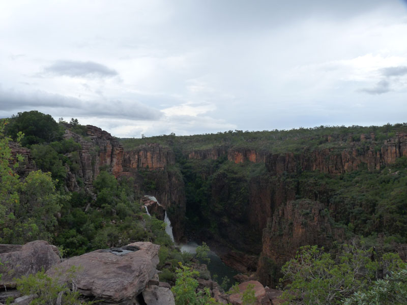
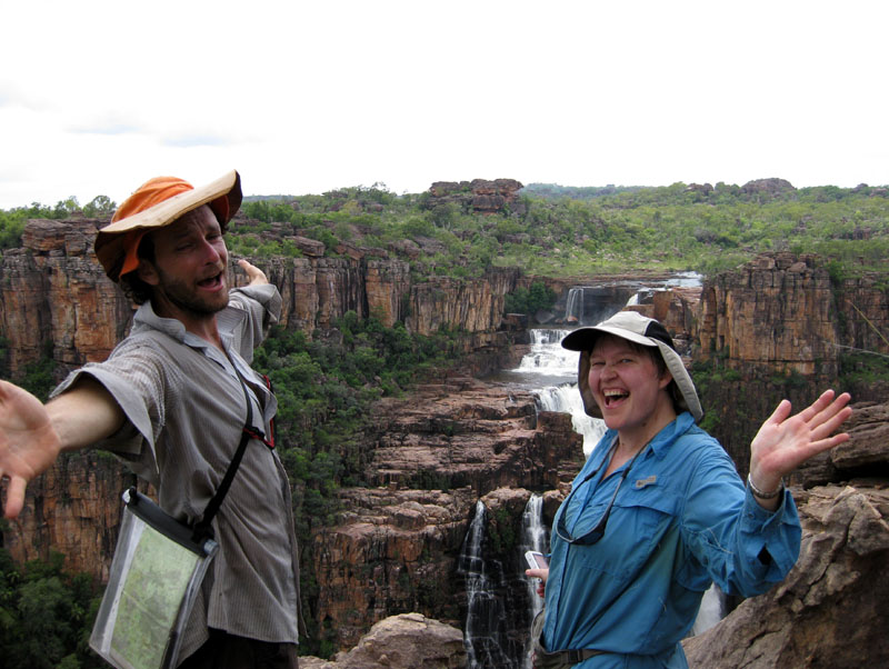
Looking down Jim Jim Gorge *
This is the view we had looking downstream from our lunch spot next to Jim Jim Falls. Outside our group, the nearest person is more than 50 km away.
View full-size photo here.
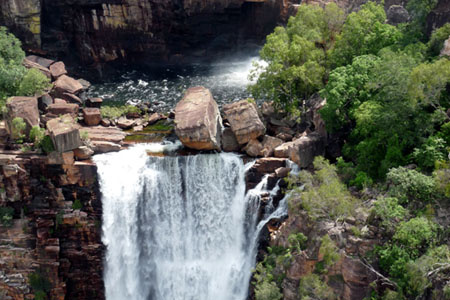
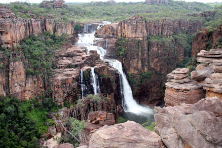
Aerial view of Jim Jim Falls *
This photo was taken from a helicopter three days after the later. Our views from the ground lasted for hours. This was over in two minutes.
View full-size photo here.
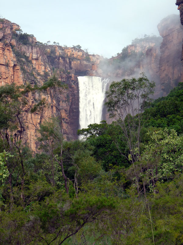
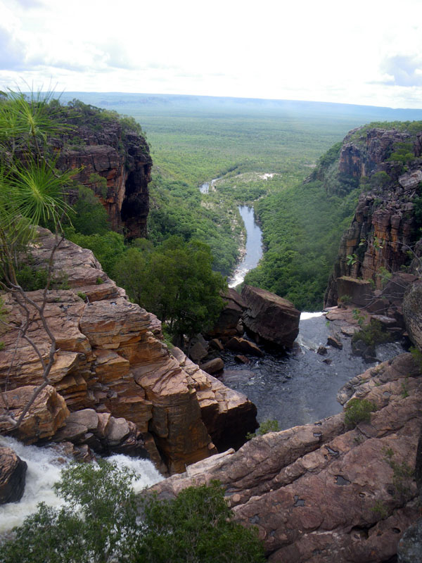
Jim Jim Falls from the bottom *
This is the view we had looking back toward Jim Jim Falls from the bottom. Willis's Walkabouts is the only tour operator who visits Jim Jim on the ground during the wet season.
View full-size photo here.
Walking between Jim Jim and Twin Falls
There is lots of grass, but most of the walking between Jim Jim and Twin falls is flat and easy.
View full-size photo here.
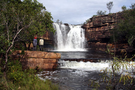
First view of Twin Falls
This is the first of Twin Falls. A day later, we get an almost unbelievably spectacular view from the other side of the gorge.
View full-size photo here.
Campsite above Twin Falls
Because of the possibility of overnight flooding, we have to camp well back from the river's edge.
View full-size photo here.
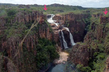
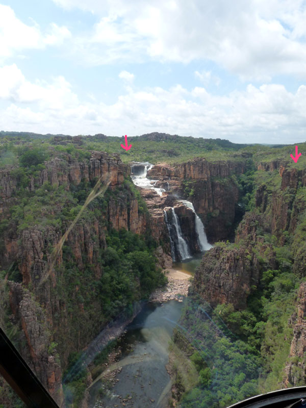
Aerial view of Twin Falls *
This photo was taken from a helicopter. The arrow on the left shows where we camped the night before. The one at the right shows where the group stood to get their best view.
View full-size photo here.
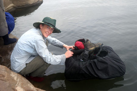
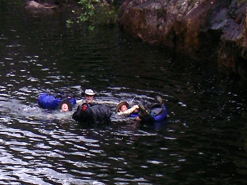
Preparing to float packs across Twin Falls Creek
To cross Twin Falls Creek, we walk upstream to where it is quieter and deeper and float our packs across. As shown, a good pack cover can keep the pack dry.
View full-size photo here.
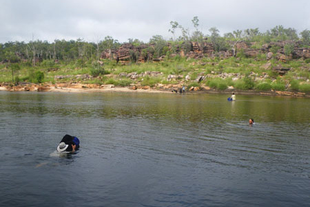
Floating packs across Twin Falls Creek
The swim across is relatively easy, but it does show why anyone who can't swim 100 metres should not consider this trip.
View full-size photo here.
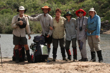
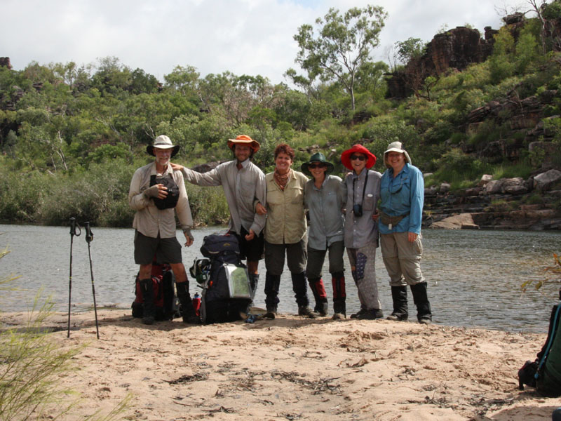
Group photo after the pack float
This photo was taken with a self timer on the beach next to the creek after the pack float.
View full-size photo here.
Twin Falls from west side of gorge
After the swim, we head back downstream on the west side to where we get this view looking back at the falls.
View full-size photo here.
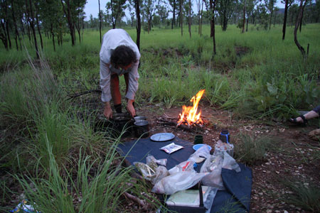
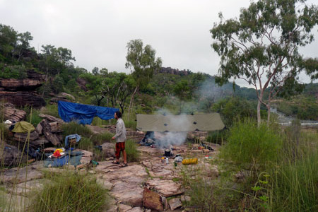
Don cooking dinner
Even at the height of the wet, we can almost always have a fire for dinner. Better still, with even the tiniest creeks flowing, we can camp almost anywhere.
View full-size photo here.
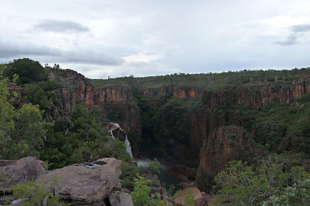
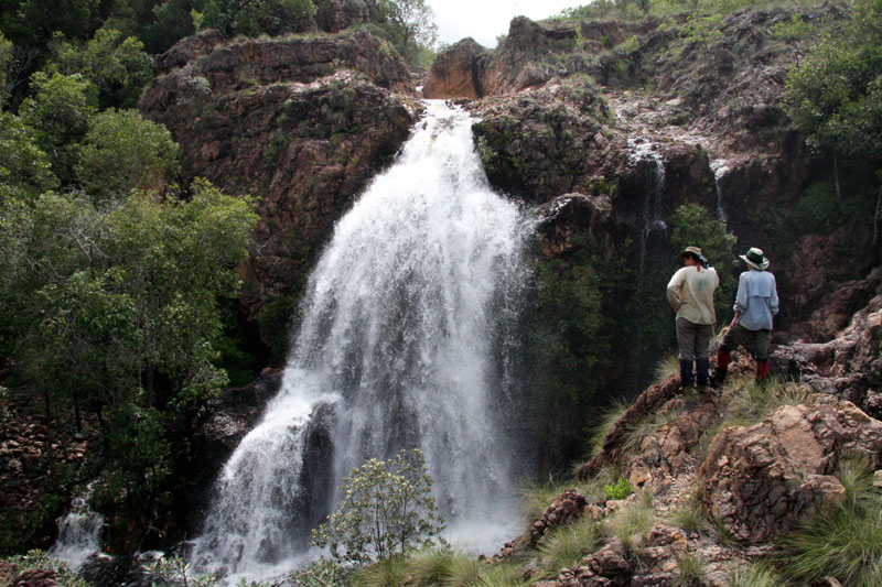
Surprise Falls
After a long walk across the plains and a climb back up the escarpment, the pools and waterfalls at Surprise make for a welcome break.
View full-size photo here.

Round Jungle
Heading west from Surprise, we come to Round Jungle, a patch of thick monsoon forest. The vegetation here is totally different anything nearby. Although it has been studied for years, no one has yet come up with a definite answer as to why it exists.
View full-size photo here.
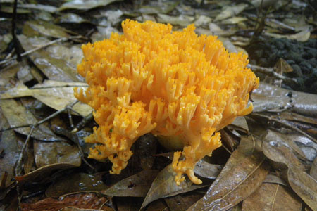
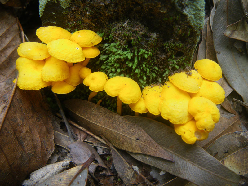
Wet season fungus
The group managed to photograph at least twenty different types of fungi. this is one of the more interesting ones.
View full-size photo here.
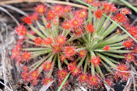
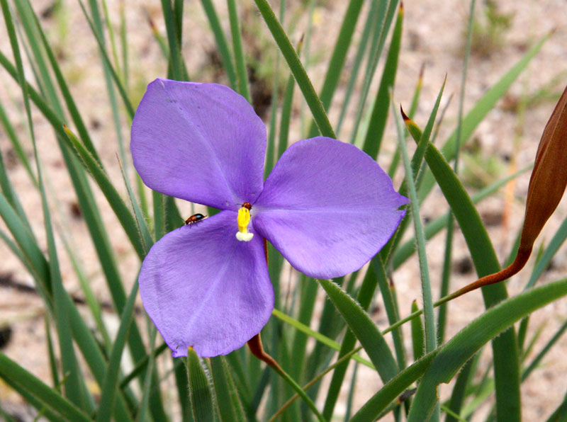
Sundew
Kakadu soil is relatively poor in nutrients so there are many insectivorous plants like this sundew. Small insects land on the droplets, stick, and are slowly dissolved by the plant.
View full-size photo here.
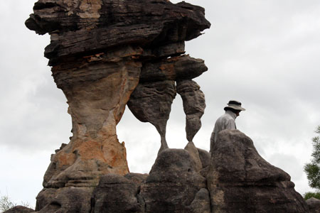
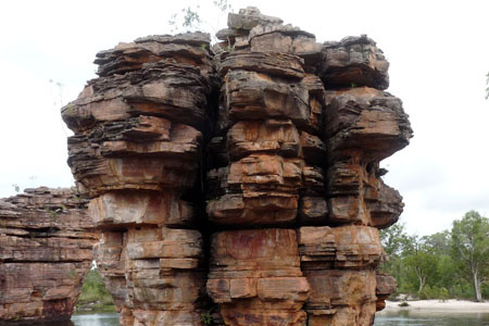
Snake Rock
Kakadu is full of intriguing rock formations. Some think this one on the upper reaches of Graveside Creek resembles the Australian cartoon character Snake.
View full-size photo here.
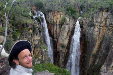
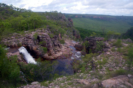
Graveside Falls *
The creek feeding the main falls at Graveside splits in two about one km upstream and plunges over two separate 80 metre drops.
View full-size photo here.
Top falls, Cascades Creek
Every trip that passes this spot stops for a swim. If it's too sunny or rainy, there is a great rock shelter where we can sit and relax.
View full-size photo here.
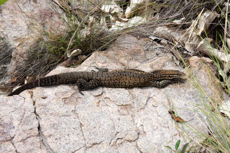
Monitor lizard
Other than birds, you seldom see many animals in Kakadu, but occasionally one will pose for you as this monitor lizard has done here.
View full-size photo here.
Cascades Creek pack float
Although it was not necessary, some members of the 2009 group decided it would be fun to float their packs through part of Cascades Creek gorge.
View full-size photo here.

Cascades in the afternoon
The Cascades were flowing well but far from full flood when the group arrived.
View full-size photo here.
Cascades next morning
It rained overnight. Next morning the flow had increased quite a lot, but it was still far below full flood levels.
View full-size photo here.
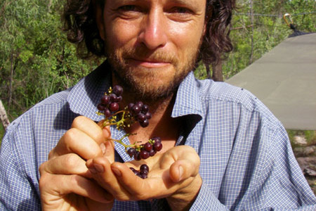
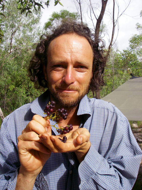
Bush grapes *
Guide Don Butcher getting ready to sample a few bush grapes ((Ampelocissus acetosa). We don't collect a lot of bush tucker, but these are good to resist.
View full-size photo here.
Rugged rock country near Gronophylum Creek
Walking through the rugged rock country near Gronophylum Creek
View full-size photo here.
Gronophylum Gorge
As we continue upstream along Gronophylum Creek, the terrain changes yet again as we come to a narrow gorge.
View full-size photo here.
Gronophylum swim
As is often the case, the pool below the falls proved irresistible so the group stopped for a swim.
View full-size photo here.
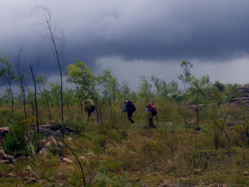
Approaching storm
Moving on from Gronophylum Creek, the group met yet another approaching storm. After all, it is the wet season. But, as is usually the case, this one soon passed.
View full-size photo here.
Emerald Pool
Emerald Pool is the largest, deepest pool in the whole Barramundi system. It gets its name from its colour in the dry season, so clear and deep it looks almost green.
View full-size photo here.
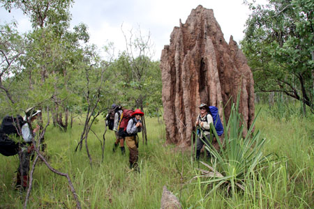
Termite mound
The cathedral termite mounds on the plains are huge, sometimes much bigger than the one shown.
View full-size photo here.
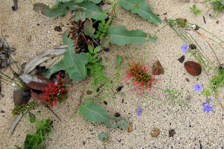
Wildflowers
red Grevillea goodii and one we can't identify. Even as the trip drew to a close, the flowers were still able to draw our attention.
View full-size photo here.
Walk's end
In a straight line, the pick up vehicle was only 50 km from where the walk began. By road it was 100. By the route the group had taken, it was an wonderful adventure through the best that Kakadu has to offer in the wet season.
View full-size photo here.
This is, in many ways, our ultimate Kakadu expedition.
- It is the only ground tour anyone offers that takes you to Jim Jim and Twin Falls in the wet season.
- It is our most strenuous Kakadu expedition — three weeks with only one food drop and no chance to join or leave in the middle. It will be hot and humid but you can always cool off with a swim.
- You see dozens of waterfalls at their wet season best.
- From start to finish, you are very unlikely to see anyone other than the members of your walking group.
The list goes on. The photos in this gallery, all taken on our 2009 trip, will give you a better idea of what it's like and why those who are properly prepared rave about the experience.
This is a serious expedition. We strongly recommend that anyone considering this trip take the time to go through this entire gallery to make sure they have as good an idea as possible about what lies in store. You don't have to be superfit to do it, but you do need to be properly prepared, both physically and mentally, to enjoy it the way it should be enjoyed.
Photos marked * are a vertical format that doesn't fit the standard gallery. Click to see the full photo.
Click here to see the detailed trip notes which describe the trip.


 share
share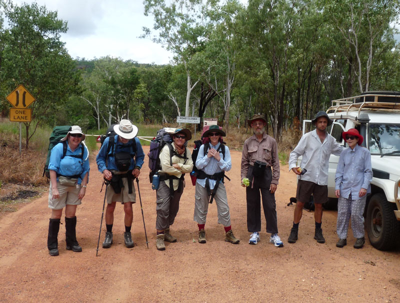