Kimberley & Pilbara
Mitchell Plateau No.3
9-22 August 2020
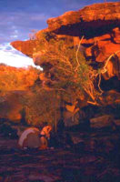
- Ecologically important The Mitchell Plateau is one of the most species-rich areas in northern Australia.
- Aboriginal art The numerous art sites may be a reflection of the diverse habitats and abundant natural food supplies.
- Last Chance Our last Mitchell Plateau trip for the year.
This trip takes you into the wilderness along the Mitchell River and some little known creeks nearby. During the walk, you will see everything from open woodland and broad river valleys to deep gorges and waterfalls.
The region contains some of the largest pockets of monsoonal vine forest in the Kimberley and is home to more mammal species than have been collected from any similar-sized area in Western Australia. Those who take the time to look carefully almost always see some of the rarer species.
As on most of our trips, there is always time to cool off with a swim.
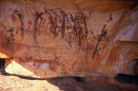
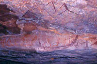
Looking for Aboriginal art sites is an important part of this trip. We will visit the best sites we found on previous trips and search for others. Although it is not yet possible to date most of the paintings, existing research suggests that the styles we see will range from early twentieth century back more than 10 000 years. If you are not particularly interested in the art, you might still enjoy poking around the various rock formations or perhaps you would prefer to relax near a pool and watch the birds or have a swim while others go exploring. The choice is yours.
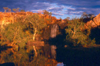
If our Mitchell Plateau No. 2 runs,instead of the normal long drive from Kununurra, we fly to the Mitchell Plateau airstrip. If not, we will have to drive. From the airstrip, a short drive takes us to the start of a relatively short walk to Surveyors Pool. Most of our food and gear will remain in the vehicle allowing us time to acclimatise and get used to our packs. Some groups do this as a day walk. On this trip we plan to spend the night.
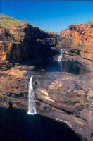
When we return to the vehicle, we do a relatively short drive to the end of the Mitchell Falls track and follow the marked trail to the top of the falls. Even at this time of year, there should still be a reasonable flow.
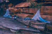
After exploring the area around the top of the falls, we cross the river and descend into the gorge below. We spend the next several days working our way slowly downstream to the lower falls from where we do a day walk to the tidal rapids formed where a rock bar blocks the river.
|
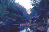
From the lower falls, we move cross country to a deep, narrow gorge which we follow to its head. The environment here is very different to that along the Mitchell so we allow extra time to experience and enjoy all it has to offer.
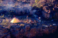
From the top of the Western Gorge, we head cross country back to the Mitchell River. After a final view out over Mitchell Gorge, we follow the marked trail back to the vehicle and begin the long drive back to Kununurra
Terrain and difficulty. Although most of the walking is relatively easy, the trip does include substantial amounts of rock hopping. Some sections will be quite rugged and others may require pushing through fairly thick scrub. People without off-track bushwalking experience are likely to find it more difficult than those who have had such experience. If you have never done any off-track walking while carrying a pack, we strongly recommend that you visit our How Hard? page and especially check the rock-hopping and climate sections to see what is involved.
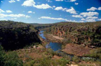
Your rewards are beautiful tropical pools, perfect for swimming; spectacular views; Aboriginal art sites and an incredible Kimberley wilderness experience no other operator can offer you.
Mitchell Plateau No.3 detailed trip notes.
For more information about this trip or to find out how to book email us for Mitchell Plateau No.3 Information
 share
share