Kimberley & Pilbara
Karijini National Park
Traversing a Rust-Red Wonderland
23 June - 6 July, 2002
This article was written by John Cannon. An abbreviated version appeared in the Sunday Tasmanian on 11 and 18 August 2002. Unless otherwise credited in the captions, John took the photos.
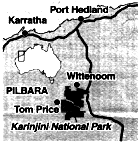
Karijini (then the Hamersley Range) National Park was proclaimed in 1969 at 617,606 ha (or about half the size of the Tasmanian World Heritage Area). It is wedged between two of the biggest iron ore deposits in the world - at Newman and Tom Price.
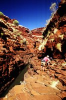
Spectacular deep red gorges dissect the northern section of the Hamersley Range, contrasting with the spinifex which ranges from straw-coloured when dry to a delicate gooseberry when well watered. Most of the park is over 650metres & more than 230 kms from coast.
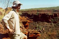
Laden with heavy packs including two litres of water, we left Fig Tree Crossing, about 170 kms north of Newman, in the heat of the noonday sun. Our aim was to cross the Park to Wittenoom in 14 days of walking doing quite a few interesting side trips along the way.
We followed a tributary of Munjina Gorge sometimes in the valley and when it got too scrubby with swordgrass or too vertical we made our way up onto the rim.
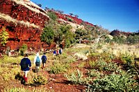
We enjoyed an eggplant and burghul main course followed by a wild rice and fruit dessert prepared by Russell Willis, the friendly proprietor of Willis's Walkabouts. We sat around on the rocks and chatted, setting the tone for our walk.
Next day we continued through to the main Munjina Gorge for a two-day base camp among paperbarks. An easy afternoon further downstream included a cooling swim.
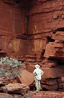
Donning day packs, we headed up Munjina Gorge, and were soon admiring a range of plants including holly grevillea and kurrajong. Further upstream in a rugged section of the rusty red gorge, we found an Aboriginal art gallery where stick figures had been painted in a yellow clay.
We continued upstream through a more open area and were surprised to find running water, ferns, and a wonderful shady pool for lunch and a siesta.
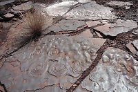
We returned across spinifex plains until we reached a slaty side gorge. Along this gorge we found concentric rings in the rock bed that looked like elements on a stove which recurred elsewhere in the Karajini. They were once thought to be fossilised jellyfish but are only the 'flattened remains of inorganic nodules'.
Back in the main gorge, we had a well-deserved swim in a pool that had been warmed by the sun.
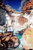
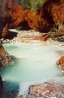
We proceeded towards Dales Gorge on a north-westerly bearing after leaving Munjina. The head of the side gorge we descended was blocked by a dry waterfall, so we made our way around the rim to a good descent route.
Two pale blue lakes in the gorge were surrounded by white salts. They were magnesium salts that had leached into the water and made it taste poisonous.
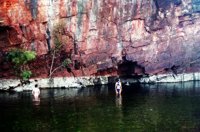
A challenging walk downstream took us to a wider valley with a much better water source. We had a refreshing swim in a pool nearby that had been warmed by the sun all day. The temperature overnight went down to a cool 3 degrees.
From there, we took a side trip up Dignam Gorge to a thermal pool. Unfortunately some of the route had been badly burnt, however other parts went through beautiful palm groves and ferns.
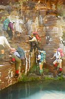
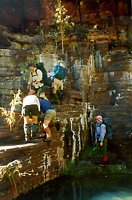
Further up Dales Gorge next day, we reached an impasse of two deep reed and swordgrass fringed pools with a vertical cliff beside them. After some unsuccessful forays into the swordgrass, we found a possible way to cross the creek between the two pools and were through to our campsite by lunchtime.
This allowed the afternoon to explore the popular short walks around Fortescue Falls where we were to be picked up by bus next morning after the first half of our walk. We had a great swim in Fern Pool and looked at the freezing Circular Pool which doesn't get much sunlight.
The part before this was the expanded version of the first newspaper story. What follows was the second.
We stopped off at the brand new Visitor Information Centre on our way to the start of the second part of our Karajini National Park walk at Kalamina Falls. The Centre apparently is designed to look like a large lizard from the air. Our other important task was to sort out all the food that had been brought in for the second stage of the walk and fit it in our packs.
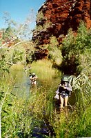
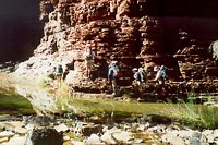
We followed the spectacular Kalamina Gorge downstream, and had to undertake two waist-deep wades through chilly waters with cliffs on both sides. Some of the party avoided one of the wades by climbing up through a spectacular rock archway.
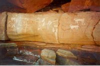
Aiming for the upper reaches of Knox Gorge, we climbed up a side gorge from Kalamina next morning and found a fantastic array of Aboriginal petroglyphs on a shady wall.
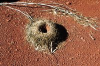
When the gully became scrubby, we climbed out onto the spinifex plains and had lunch in a dry creek bed. Continuing across the plains, I stood on a standing dead stick and it spiked right through my boot but fortunately didn't penetrate my foot. By mid-afternoon, we reached a base camp that would serve us for three nights.
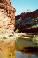
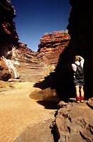
We made two side trips from it: one to the spectacular Joffre Falls and Gorge and the other downstream along the cliff-girt Knox Gorge. Some of us elected for R&R (resting, reading and swimming) on one of these days.
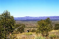
Pressing on after these two side trips, we made our way out of the Knox Creek valley onto a prominent hill. From there we enjoyed expansive views across the serrations of the Hamersley Range and looked down into Wittenoom Gorge -- the longest descent of our trip.
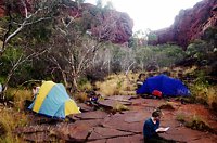
A 60-metre dry waterfall thwarted our first descent route and our second attempt didn't seem much more promising. We had to descend a steep slope on loose shaly rock between spinifex. It required 110% concentration not to fall onto the spiky spinifex and end up like a pincushion or worse still keep rolling down the slope.
It was tedious going in the heat but we eventually reached the bottom of the gorge. Hot after the long descent, the water in the gorge was too cold for anything more than a birdbath.
We explored the head of Wittenoom Gorge through a beautiful grove of silver paperbarks burnished gold by the red walls of the gorge. At the far end of a freezing pool we saw Knox Gorge and Red Gorge join to form Wittenoom Gorge.
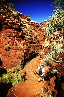
We went downstream to a campsite below the only feasible route out of the gorge towards the tourist hot spots of Weano and Hancock Gorges. They were our next objective for a day trip walking around the rim above Red Gorge until we reached a bluff opposite Oxers Lookout. We were spellbound by the steep gorge junction of Joffre, Weano and Hancock Gorges.
We descended into Weano Gorge and had a look at Handrail Pool. After a brief geology lesson in the interpretation booth, we made our way into the deeper Hancock Gorge for a leisurely lunch at Kermits Pool.
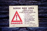
A radio telephone above the gorges could be activated in the event of an emergency by pressing a button. A ranger told me that there have been twelve fatalities in the Park over the past 20 years. These are mainly the result of novice visitors attempting to climb down gorges beyond their capabilities.
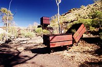
We retraced our steps back down into Wittenoom Gorge after a full day and had our last bush evening meal together: yummy gado-gado followed by cheesecake. The final walk out to the end of the road where the Wittenoom blue asbestos mine operated from 1943 to 1966 was harder than expected. We had to cross the river five times and there was a lot of rock hopping.
We were delighted to meet a lady who runs a cake and jam stall at the end of the road. She has been raising money for cancer research for many years but it's not every day of the week that a group of ravenous walkers descend out of the hills and buy all her cakes.
We had completed the walk but sustaining memories of it will recur for some time to come and help us through long days in front of the computer.
John Cannon, Hobart
See more photos in the Karijini Gallery
April Karijini trip notes
June-July Karijini trip notes
 share
share